Unrasterize
Motivation
Raster data formats have become increasingly popular to represent global population density (see, for example, CIESIN’s Gridded Population of the World). But the sheer number of pixels can make working with raster data difficult for certain use cases.
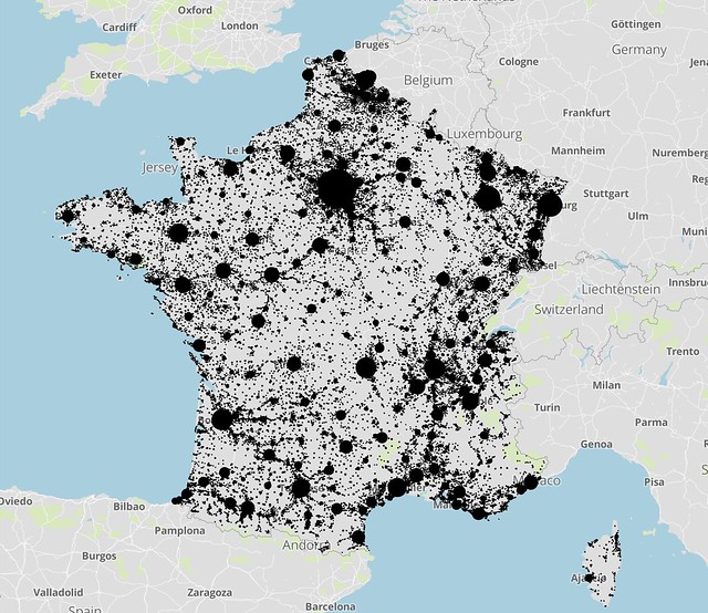
Enter unrasterize, a lightweight package to extract representative population points from raster data. The resulting points exist in vector format (i.e., GeoJSON) and can be used by downstream applications.
Sample Output
Contents
Usage
For an example of unrasterize in action, see this Jupyter notebook.
Unrasterize API
The following classes exist to convert raster data to GeoJSON.
For large raster files, the WindowedUnrasterizer is the most memory efficient, with the caveat that it may select some points from adjacent windows that are very close together.